SAN DIEGO COUNTY, Calif. — Due to snow and predicted freezing temperatures, schools in the Julian Union Elementary and Julian Union High School districts will be closed on Wednesday, Feb. 16 and they will have a late state on Thursday, Feb. 17, San Diego County Office of Education said in a press release on Tuesday night.
On Feb. 16, Spencer Valley School District will also be closed for a snow day and Warner Unified School District will have a two-hour late start.
San Diego County received its first round of measurable rainfall in nearly a month as a low-pressure system pushed south from the Pacific Northwest. Light rain showers began early Tuesday morning and strengthened by the late morning toward the afternoon and into the evening.
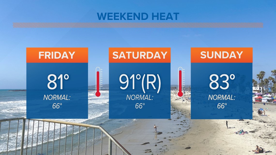
Although accumulations are expected to remain light compared to what a typical February would bring, it will show a dramatic shift in the weather compared to record-breaking heat and sunshine from just a few days prior.

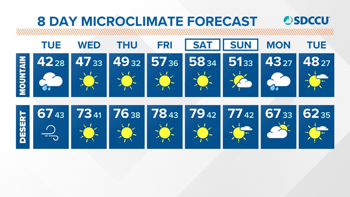
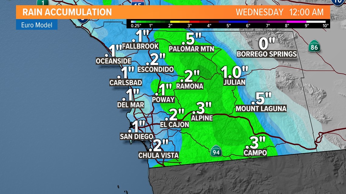
This event will be contained to Tuesday and taper off by early Wednesday. Accumulation totals will likely reach between a few one hundredths of an inch and a tenth of an inch across the coast of San Diego. Inland valleys can expect between one and two tenths of an inch while mountain ranges will likely see the heaviest accumulations -- closer to half an inch. While this will arrive as rain at first over the mountains, snow levels will drop down to about 4,500 to 5,000 feet, meaning there is a chance for an inch to two inches of snow for local mountains, with heavier accumulations at ski resorts to the north of us.

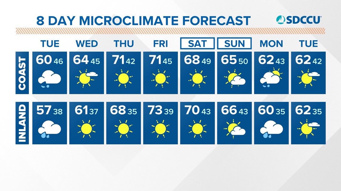
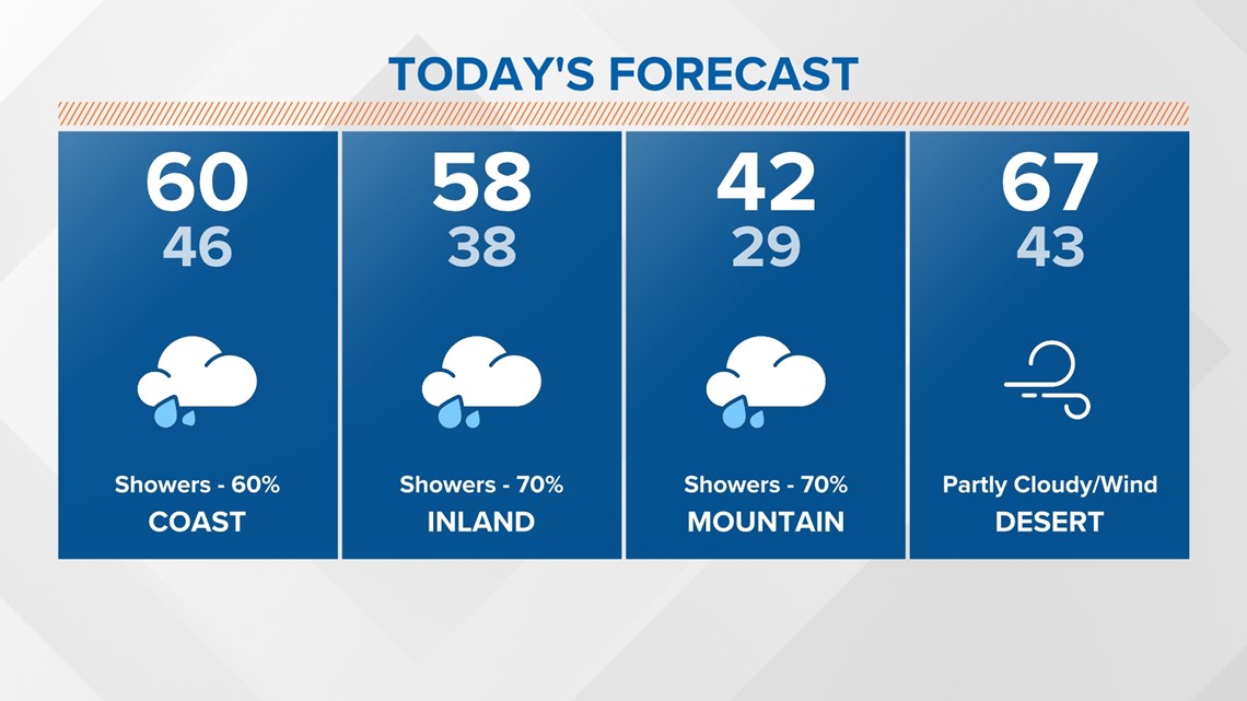
Early Tuesday, significant cloud cover held on to some of the warmth from Monday, keeping overnight lows warmer than normal and warmer than just a day prior. By Tuesday afternoon we can expect only minimal increases in temperatures, with highs in the upper 50s and low 60s. Keep in mind, in many cases this is a more than 30 degree drop from record-breaking temperatures seen over the weekend.

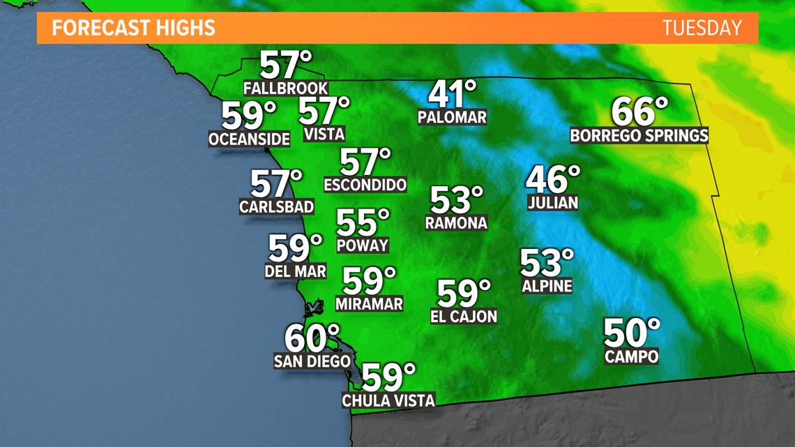
Just the weekend prior to this, we saw plenty of abnormal winter heat. Say goodbye to this type of summer warmth as temperatures settle closer to average, if not slightly below average for Tuesday afternoon.

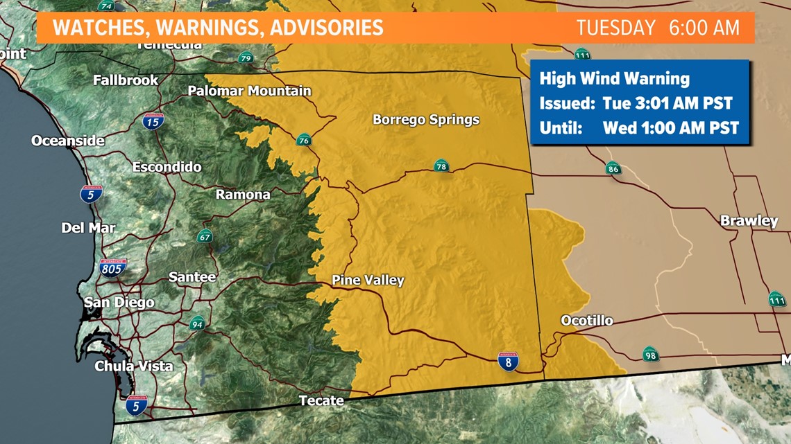
As far as local weather alerts issued by the National Weather Service, wind is the top concern. A High Wind Warning is in effect until early Wednesday for San Diego County mountains and deserts with sustained speeds between 25 and 35 mph and gusts up to 70 mph. Damaging winds could blow down power lines and trees, and high profile vehicles can expect difficulty especially over mountain passes.

Behind this trough, a ridge of high pressure will build, bringing a return to dry conditions and sunshine. However, by the late weekend, into early next week, there is a chance for more wet weather in the forecast.

