As another year comes to a close, the News 8 Weather Team has come up with their annual list of the Top San Diego Weather Stories for 2017.
For a town that doesn’t get credit for having a lot of weather, there’s quite a bit of diversity on this list.
In no particular order, here are the Top San Diego Weather Stories for 2017:
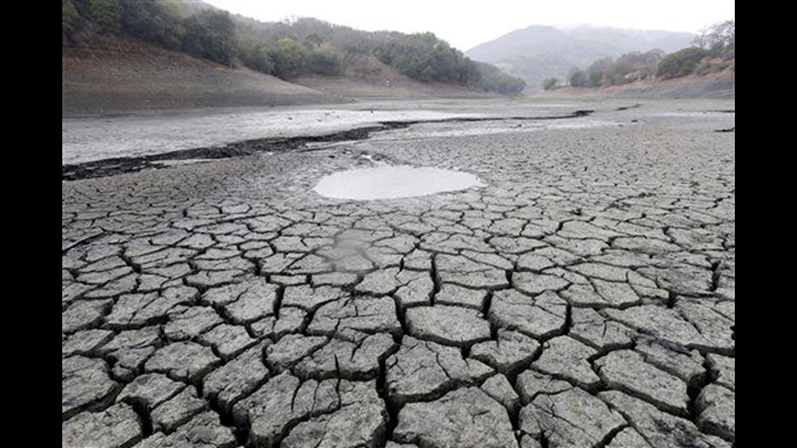
The end of a years-long drought


A healthy rainy season that started at the end of 2016 continued into 2017, with January and February considerably wetter than normal. Many, many respected weather experts (and some not-so-respected politicians) expected San Diego would need several wet winters before getting out of the drought.
This isn’t to say one still shouldn’t conserve – you absolutely should! There’s no way to know when the next drought will get going, but for everyone in California (not just SoCal!) this was great news.
RELATED: Drought over for San Diego region
The Sunday, May 7 'winter' snowstorm
There was RECORD COLD (countywide, with the “coldest high temps” for the date), RECORD RAINFALL, and RECORD SNOWFALL that included 10” at Birch Hill, and 6” at Mt Laguna. This rare late winter-like May storm brought 1” to 2” of rain inland, with 1” along the coastline, and snowfall in our local mountains still visible on Tuesday morning, May 9th.
This followed a stretch of heat the previous week that included mid- to upper-80s inland most of the week. . .so it was a wild swing from August weather to seriously winter-like weather in a period of just three days.
RELATED: Padres game rained out for third time in Petco Park history and Trying to explain this weekend's wild weather
24-hours of constant rain


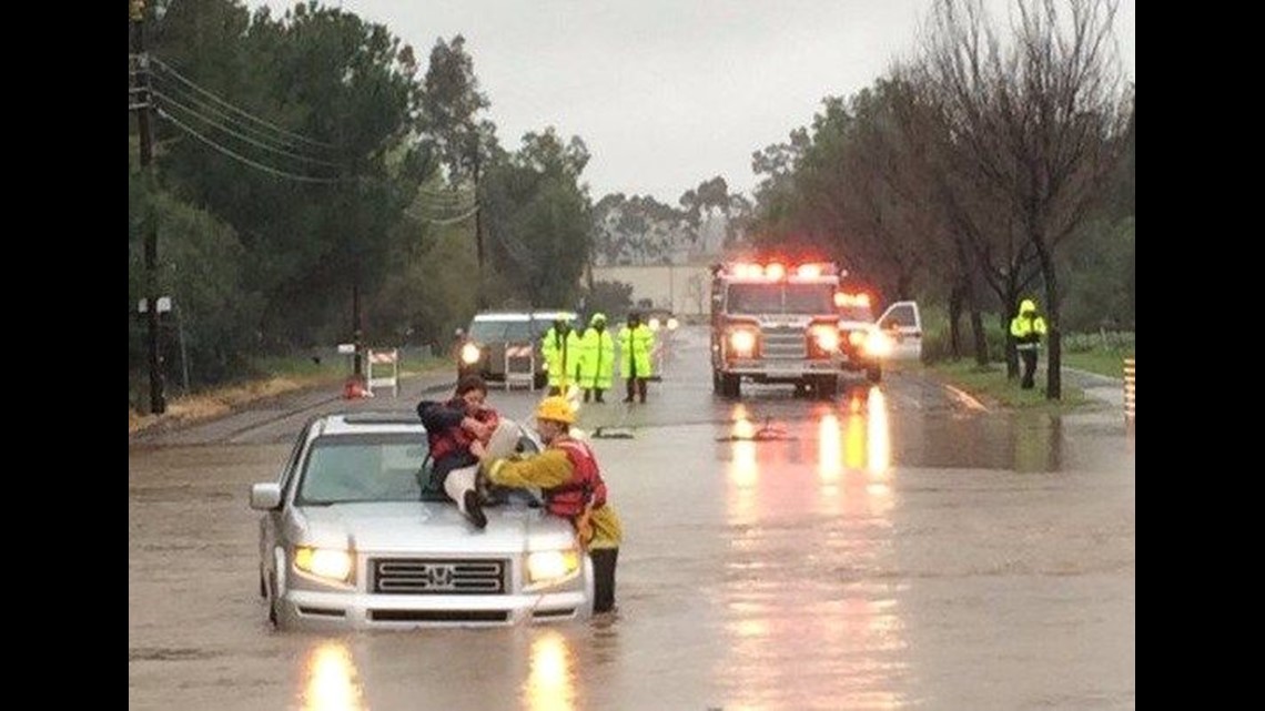
One of the reasons San Diego ended up out of the drought in 2017 was a series of atmospheric rivers that directed copious amounts of rainfall right to San Diego’s coastline. And one of these days was February 27th, when rain fell across the county non-stop for 24 hours. It started at midnight, and there was not a break in the rain at any point during the overnight hours, morning, afternoon or evening, and the result was record rainfall everywhere (including 2.10” in Carlsbad!) along with some serious San Diego River flooding.
March/April 3rd driest two-month period on record
When the rain spigot shut off at the end of February, it was off for over nine weeks. March and April are generally towards the tail end of the rainy season, but in 2017, March (.01”) and April (.08”) combined to create the 3rd driest two-month March and April since San Diego has been keeping records (1851). (These two months combined for only 3% of our normal rainfall that typically falls in March and April.) After having such an incredible rainy season, along with the declaration that the drought was over, it seemed unfortunate to appear to be starting a brand-new drought – but we won’t know for sure if a new drought is underway until the next rainy season shows up.
The Gloom Returneth
Two solid weeks of no sunshine! The last three days of May and the first eleven days of June provided San Diego with two solid weeks of what’s affectionately (?) known as the “June Gloom.” During this period, the coastline saw a total of 4% of the available sunshine – which for one day, does not amount to much at all – but for FOURTEEN days, likely set seasonal affective disorder in motion for many San Diegans. (During this same period, Seattle, Washington, had 29% of their available sunshine, so you see what’s what.) Occasional night and morning drizzle, along with temperatures a few degrees cooler than normal, helped reinforce one of San Diego’s most well-known weather patterns for the time of year.
Hottest temperature ever in San Diego County at 124°F
High pressure set up over the Four Corners during the second half of the month of June, which provided a bump in high temperatures for everyone (including along the San Diego coastline!). But nowhere was the hot weather more oppressive than out in the deserts, where 124°F was observed at Ocotillo on June 25th. This reading set a new record for the hottest temperature ever recorded in San Diego county.
Highest dewpoint temperature ever (we think), west of the mountains
Monsoon moisture that showed up at the beginning of August produced, not only thunderstorms right off the bat, but those thunderstorms helped propel the dewpoint temperature in Ramona to 76°F! The National Weather Service in San Diego does not keep records when it comes to dewpoints, but neither their office (nor ours) can ever recall a dewpoint that high west of the mountains. (The dewpoint temperature is an absolute measure of moisture in the air, and all you really need to know is when it’s in the 60s, it’s uncomfortable outside. A dewpoint in the 70s is oppressive. But 76!) Ramona residents will always remember this day.
'Dog Days of August' came very early, then Thanksgiving-like weather for weeks
While the last few days of July were lovely, monsoon moisture streamed in overnight at the change of the calendar – and the result was intense thunderstorm activity, along with hail, flooding rains, and plenty of lightning. The first three days of August felt like a steam bath (see above re: Ramona’s dewpoint) and the moisture was slow to leave San Diego. Typically, this is the kind of weather we see later in August, but there was no question that the page of the calendar was turned with this crazy summer weather. THEN – it was some of the “May Gray” by the middle of the month. A low-pressure trough that set up along the coastline propelled a deep marine layer which produced measurable rainfall, consistent cloud cover and record cold temperatures across the county. It lasted only a few days, but overall the month ended up being colder than normal.
Three October Heat Waves
October is typically the month that begins the offshore flow and Santa Ana winds for San Diego. But –THIS- October was different, in that there were three distinct heatwaves during the month. . .including one that lasted five days the last week of October, pushing record temperatures all the way to the coastline, including upper 90s at the beaches.
The 108° reading on October 26th tied the hottest temperature in California that late in the year. San Diegans were really, really, happy to see November 1st arrive, and the first two weeks of November were chilly and cloudy.
Driest Autumn season since 1929
Generally, our rainy season begins in November – although previous to November there will be some monsoonal storms in late summer, and sometimes the rains begin (even slowly) in late October. In 2017, these rains did not get going until Christmas week, and the result was 0.09” of rain from the first day of autumn until the first day of winter. This was the 2nd driest autumn on record in San Diego (1929’s trace of rain during this 90-day period the only drier). This dry spell contributed quite a bit to the late wildfire season that would show up in December.
Lilac Fire


Strong and gusty winds developed on Thursday, December 7th, and there was a Red Flag warning in effect. (San Diego’s fire danger had been placed in the “extreme” category as a result of the expected hot and dry weather.) Then a fire started at 11:27am near I-15 and the 76. This fire would consume 4,100 acres, kill numerous horses, destroyed 157 buildings and damaged another 64. It took two weeks to be completely contained and extinguished. The Lilac Fire as it was come to be known, was the worst fire in San Diego since 2007.
Hottest night ever in San Diego
The hottest night ever in San Diego was Saturday night of Labor Day weekend.
A strong high-pressure system produced a six-day heatwave during the last week of August across Southern California; at the same time Tropical Storm Lidia was slowly weakening and working its way up the west coast of Baja California.
Just as this high was moving away to the east on Saturday evening, September 2nd (right after sunset), Lidia's counter-clockwise circulation drew some of this already-heated air back into San Diego county from the east - up and over our mountains, then down to the ocean - providing some ADDITIONAL downslope warming (which we did not need).
San Diegans went to bed that Saturday night, expecting things to cool off (as it does during the overnight hours) - but the result on this night was very different. The air actually heated starting at 9 p.m., and continued to do so until midnight, when temperatures were close to 90° up and down the San Diego coastline. If you didn't have air conditioning, you couldn't sleep - and there was no relief. Temperatures ranged from 88° to 97° every hour on the hour from midnight to 7am, and in every reporting location. The heat did not subside until 8am on Sunday, which hopefully led to some naps. (The National Weather Service 12-hour overnight lows posted as of 5am, all occurred before bedtime.)
The National Weather Service in San Diego does not keep records on this sort of thing, so it can’t be official - but trust us, there has never been a hotter overnight in San Diego - and won't be again in your lifetime. It was a "perfect storm" for this event to take place, with all the overnight lows in the mid-80s taking place at 8pm the night before. Quite the finish to the unofficial end of summer!
Visit the News 8 weather page for the latest conditions and to see what 2018 brings.


