
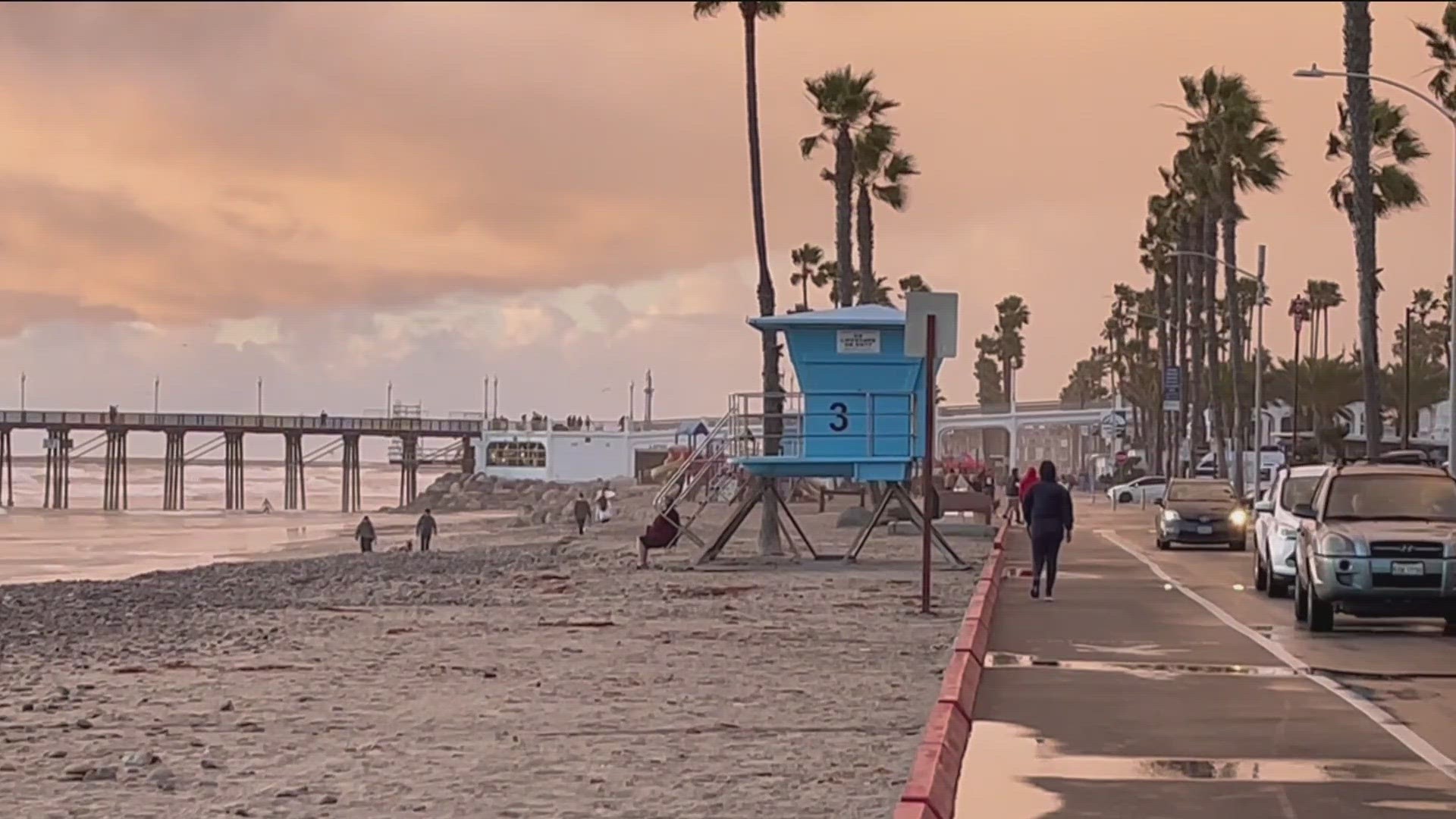
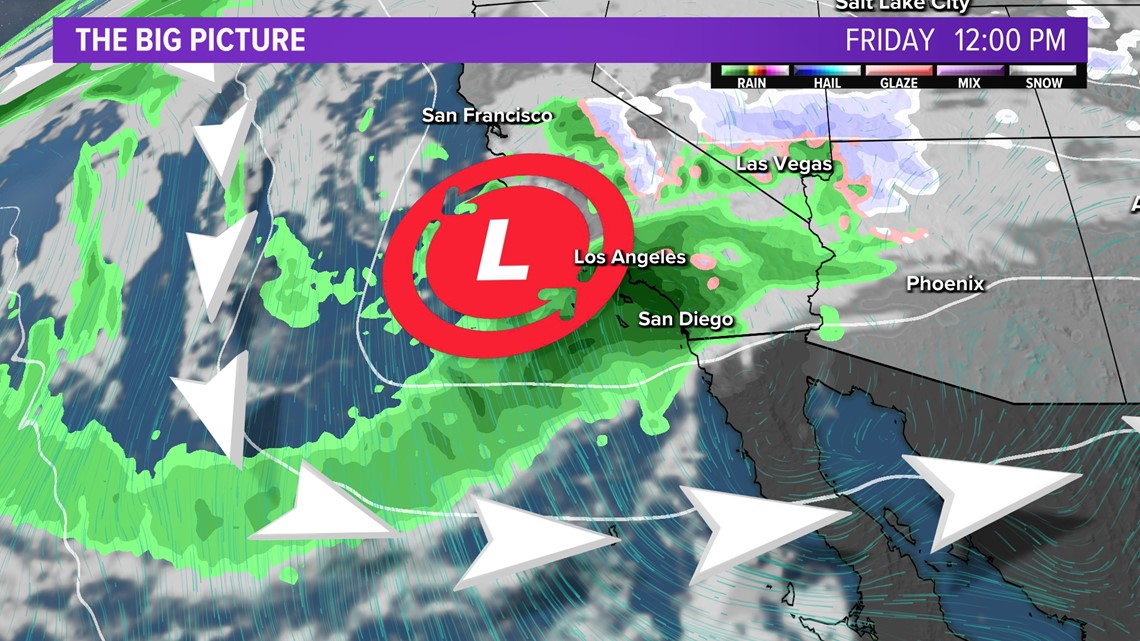
SAN DIEGO — Just over a week after record-breaking rainfall around San Diego County, residents are dealing with additional atmospheric rivers expected to pound Southern California with heavy rain, wind, mountain snow and high surf. The first of two storms arrived on Thursday and brought widespread, heavy precipitation mainly through the morning and midday hours, accumulating to roughly an inch in most spots of the county.
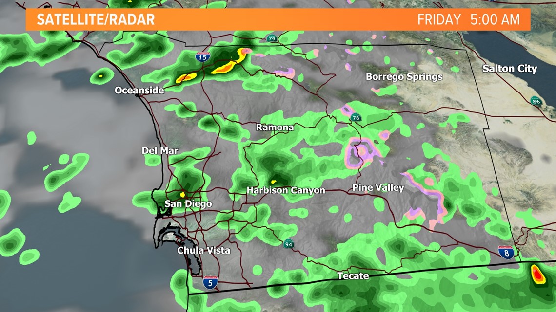
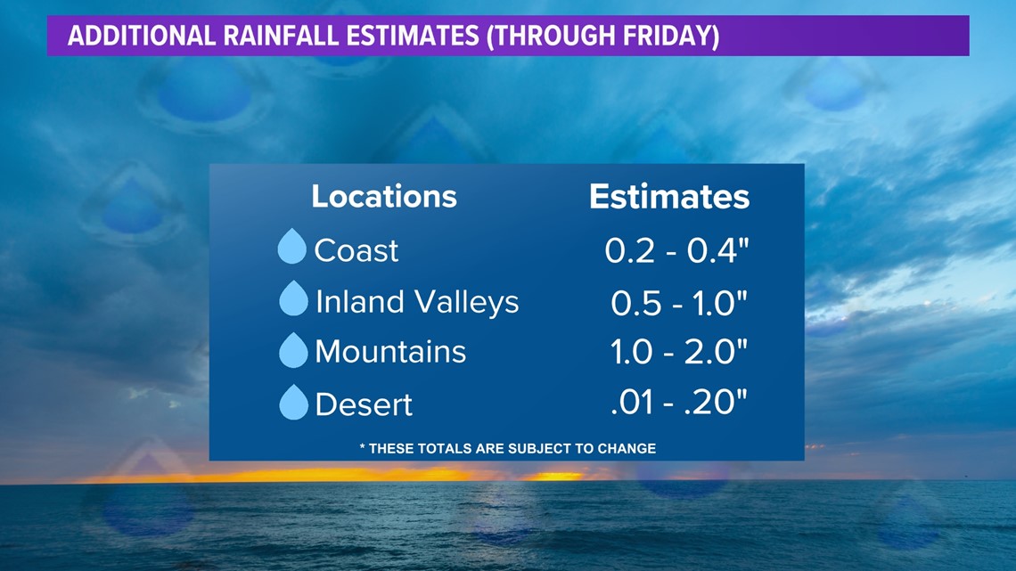
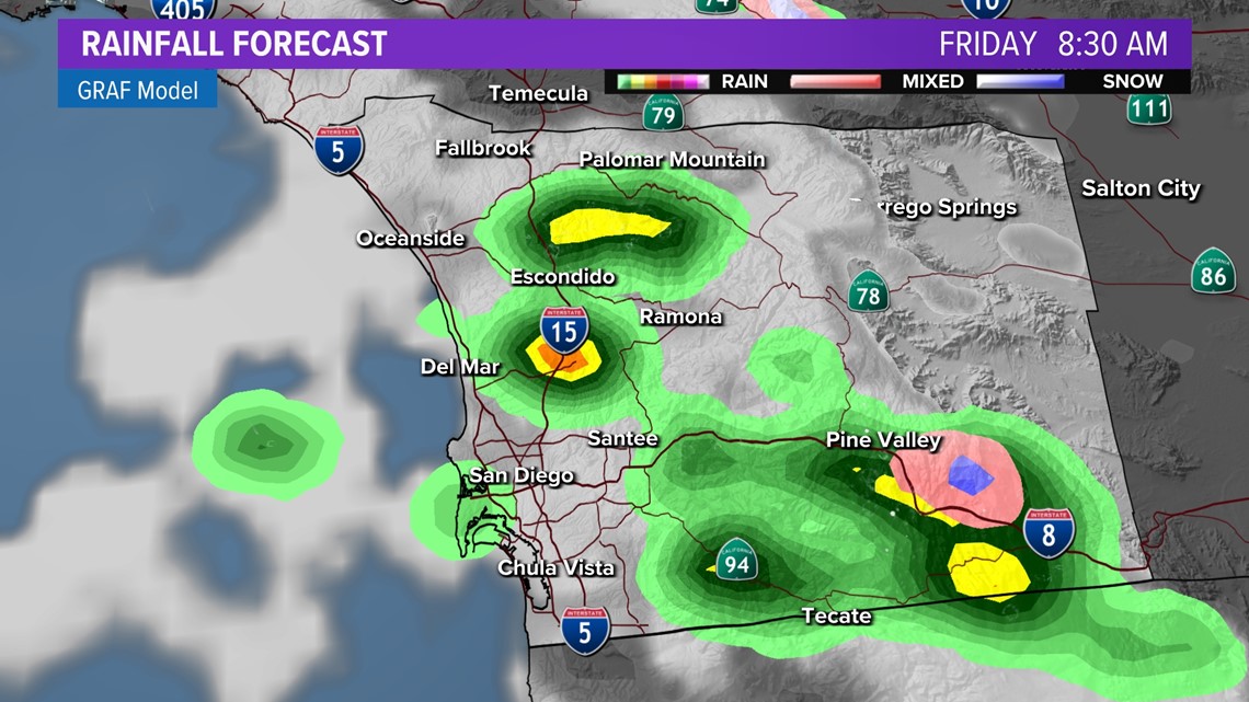
Scattered showers will persist through the day on Friday following more widespread rain that took place on Thursday. Additional accumulations will mostly stay on the lighter side, with most models giving San Diego County about a quarter inch (0.25") of additional rain accumulations through the morning and afternoon stretch.

Interactive Radar Map | Follow the rain as it moves into San Diego County
A second, more intense atmospheric river will essentially stall over Southern California early next week, with a good chance of several inches of additional rain and possibly severe impacts from Monday to Thursday of next week.
Summarizing Storm #1 & what's left:
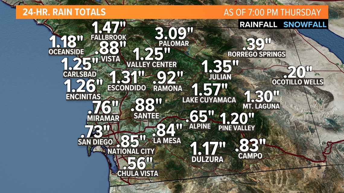
The first storm arrived Thursday morning and intensified throughout the morning and into the afternoon. North County cities including Encinitas, Carlsbad, Escondido and Oceanside received more than an inch of rain. Downpours in those cities prompted a Flash Flood Warning on Thursday afternoon. It has since expired.
The warnings and advisories that were issued on Thursday were part of a storm system that entered San Diego Thursday morning. Below are rainfall totals so far and with light to moderate rain still in the forecast through Friday, these totals will likely increase.

NOTE: Rain/snow totals and rates are likely to change as we get closer to a rain event. It's suggested you keep checking forecasted adjustments leading up to any given storm.

Most activity on Friday will be scattered and sporadic but still capable of dropping quick-moving rounds of light to moderate rain at times. In the mountains, due to the snow level near 4,000', we could also see 1 to 3 inches of snow.

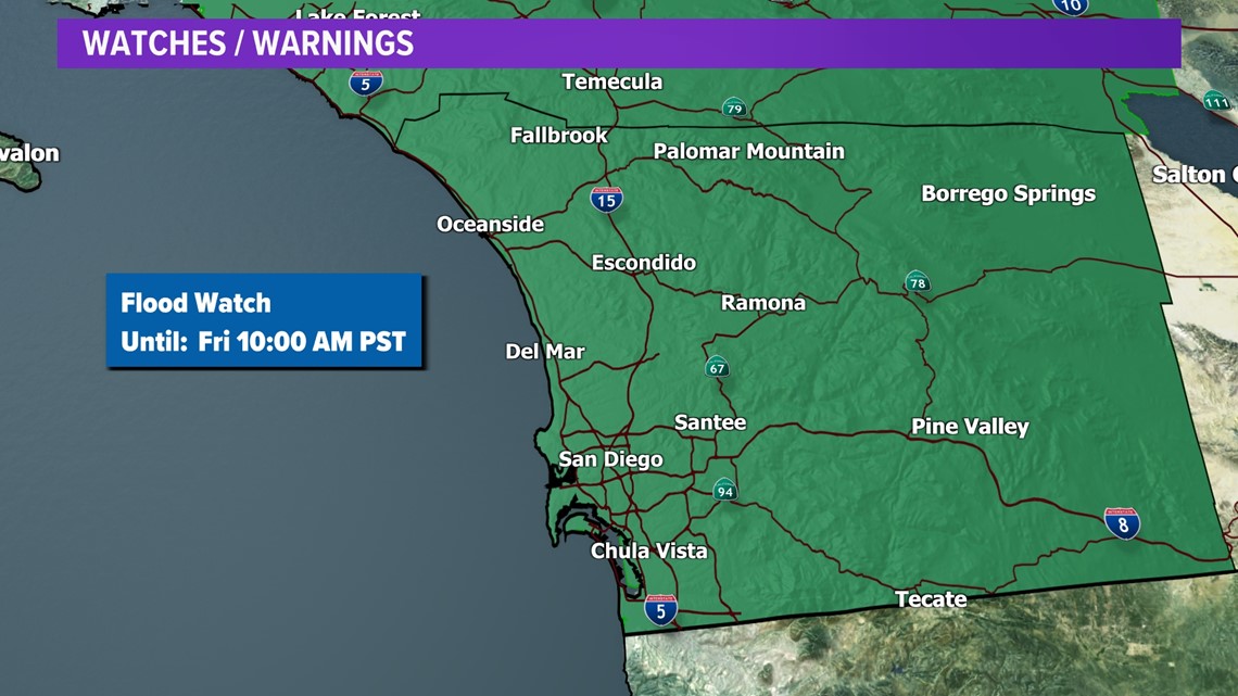
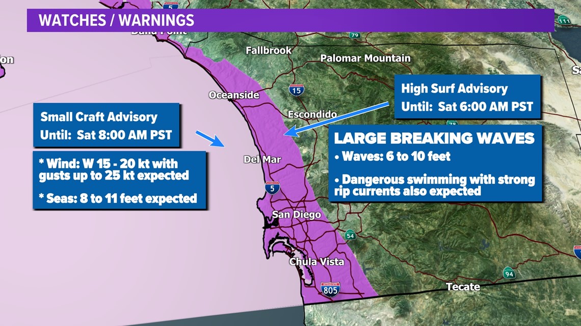
Weather Alerts
Here are the alerts that have been issued by the National Weather Service.
A Wind Advisory is in effect starting at 10:00 a.m. Feb. 2 until 4:00 a.m. Feb. 3. for the entire county.
A High Surf Advisory will remain in effect until 6:00 a.m. Saturday, Feb. 3 along the coast.
A Small Craft Advisory will remain in effect until 8:00 a.m. Saturday, Feb. 3 for boaters.


Rain rate expected
The issue that arose one week ago was mainly the speed at which the rain fell, also known as our rain rate. In some spots across the county, rain was falling at about a half an inch to an inch per hour.
While this storm showed the opportunity for localized flooding, total accumulations remain lower than last week's storm, indicating that while flooding will be a concern again, it will likely be to a less damaging extent than what was seen last Monday.
Overall, indications point to this pair of winter storms being spread out over a longer period as opposed to all at once (like last week). This gives more hope for storm infrastructure to be able to handle and drain the excess rainfall. The storm that came last week broke records for how much rain fell in a single day and how much rain fell in a matter of hours.
RELATED: 'A thousand-year storm event' | San Diego officials respond to flooding in Southeast San Diego
While this storm carried a good amount of intensity with it, we call last week's storm a 'one in 50 years' or 'one in 100 years' storm for a reason... because it only comes every 50 to 100 years -- not every week. Again, that's not to say flooding won't happen, but that if it does, it will likely affect fewer residents with less devastation and overall intensity and rate of rainfall will likely be less than what we saw one week ago.
Weekend lull, Storm #2: Monday to Thursday
The second storm in this 'series of storms' will primarily affect San Diego County on Monday through Wednesday, though some models show wet weather lingering through Thursday. This should allow for a brief lull in activity for the upcoming weekend. As we sit in-between systems, there is a slight chance for showers mainly Sunday afternoon and evening but the bulk of this Saturday and Sunday will be dry.

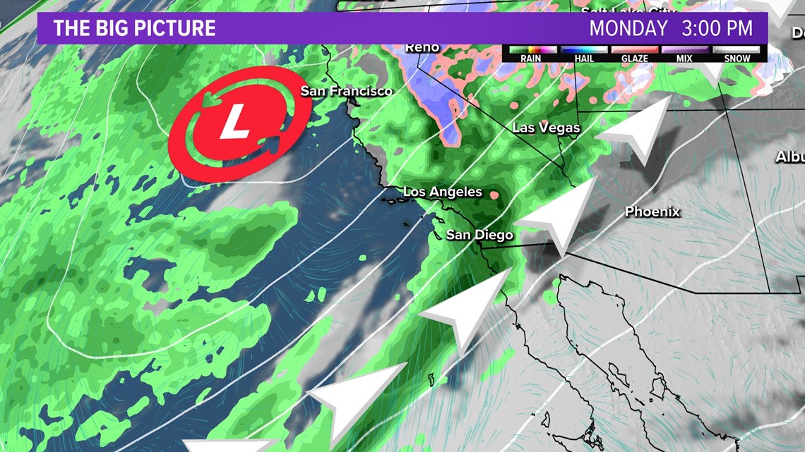
More moderate rainfall looks favorable on Monday with heavier activity moving in Monday night through Tuesday. We'll get back to chances for light to moderate rainfall Wednesday.
The big talker with the next storm is the slow pace of the storm system. This will allow the low pressure system to pick up subtropical and tropical moisture that could be funneled in across Central and Southern California as it meanders close by. This setup has the potential to bring significant rainfall as another atmospheric river event.

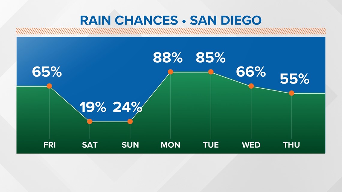
As of Thursday evening, forecast models are suggesting rainfall estimates between 1 to 4 inches for most areas early next week. Additionally, we could see 3 to 5 inches in the mountains. This is all subject to change as we get closer to this rain event. It is just the thought process at the moment.
That low will finally lift out by Thursday, but we won't be done with chances for wet weather. Another area of low pressure will keep the jet stream dipped over the West. Overall, next week looks to be a soaker.

WATCH: After the flood | San Diego neighbors recover from storm