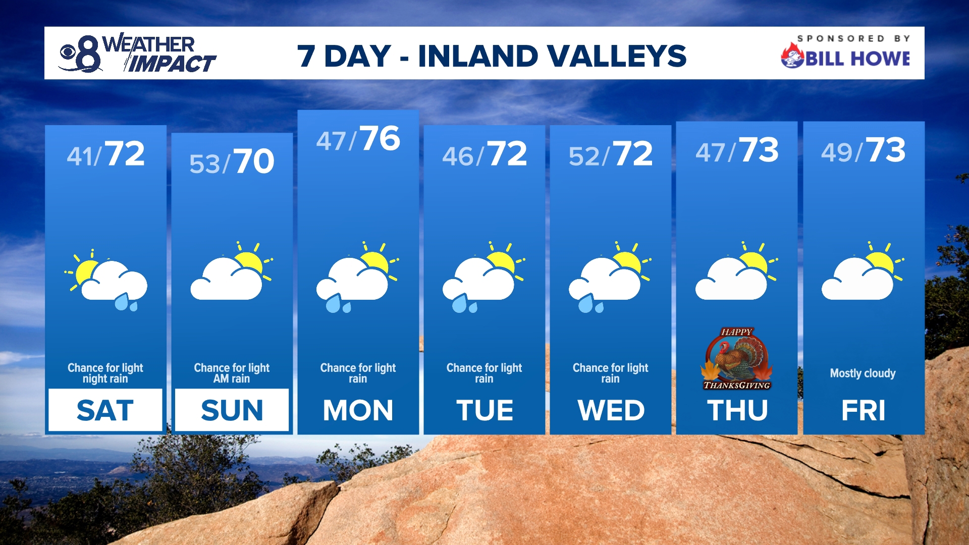
SAN DIEGO — A more unsettled stretch of active weather will bring us passing clouds and a chance for light rain as early as Saturday night and into the first half of next week.
High pressure will be swapped out for an area of low pressure over the weekend. The low is creating a big dip in the jet stream over the West and has a strong atmospheric river moving through Northern California. This plume of moisture will dry out as it makes its way through the Golden State. Once it reaches Southern California, and more specifically, San Diego County, it will be much weaker.
Clouds will build throughout the day on Saturday ahead of the system as winds start to pick up by the afternoon hours. As it closes in, models suggest a chance for light to moderate rain showers from Saturday night through early Sunday morning with a mostly cloudy sky and drier conditions for the rest of Sunday.


Once the weakened atmospheric river moves out, an area of low pressure will slowly sweep by to the north of us. This will keep rain chances in the forecast from Monday through Wednesday night. Though the chances don't look likely, there is still a chance for additional rainfall, on-again, off-again activity, during this time frame. Slick roads will be the main hazard from Saturday night through Wednesday night. Please use caution!


SATURDAY TEMPERATURES:


SEASONAL (AVERAGE) DAYTIME HIGHS:
- Coastal highs near 69 to 71 degrees
- Inland valley highs near 72 degrees
- Mountain highs near 57 degrees
- Desert highs near 77 degrees
AT THE COAST:


WEEKEND TIDES:


Shower chances will dry up as a weak area of high pressure moves in by Thanksgiving Day. We'll still see partly to mostly cloudy skies for Thanksgiving and Black Friday as temperatures continue to peak near to slight below seasonal for most of the county.


Stay current on the microclimate forecast by downloading the CBS 8 app on your cell phone and the CBS 8+ streaming channel on Roku and Amazon Fire TV. There you’ll find all our newscasts, specials, the latest weather forecasts, breaking news, and much more.


HERE ARE MORE WAYS TO GET CBS 8:
ADD THE CBS8+ APP TO YOUR STREAMING DEVICE Roku | Amazon Fire

