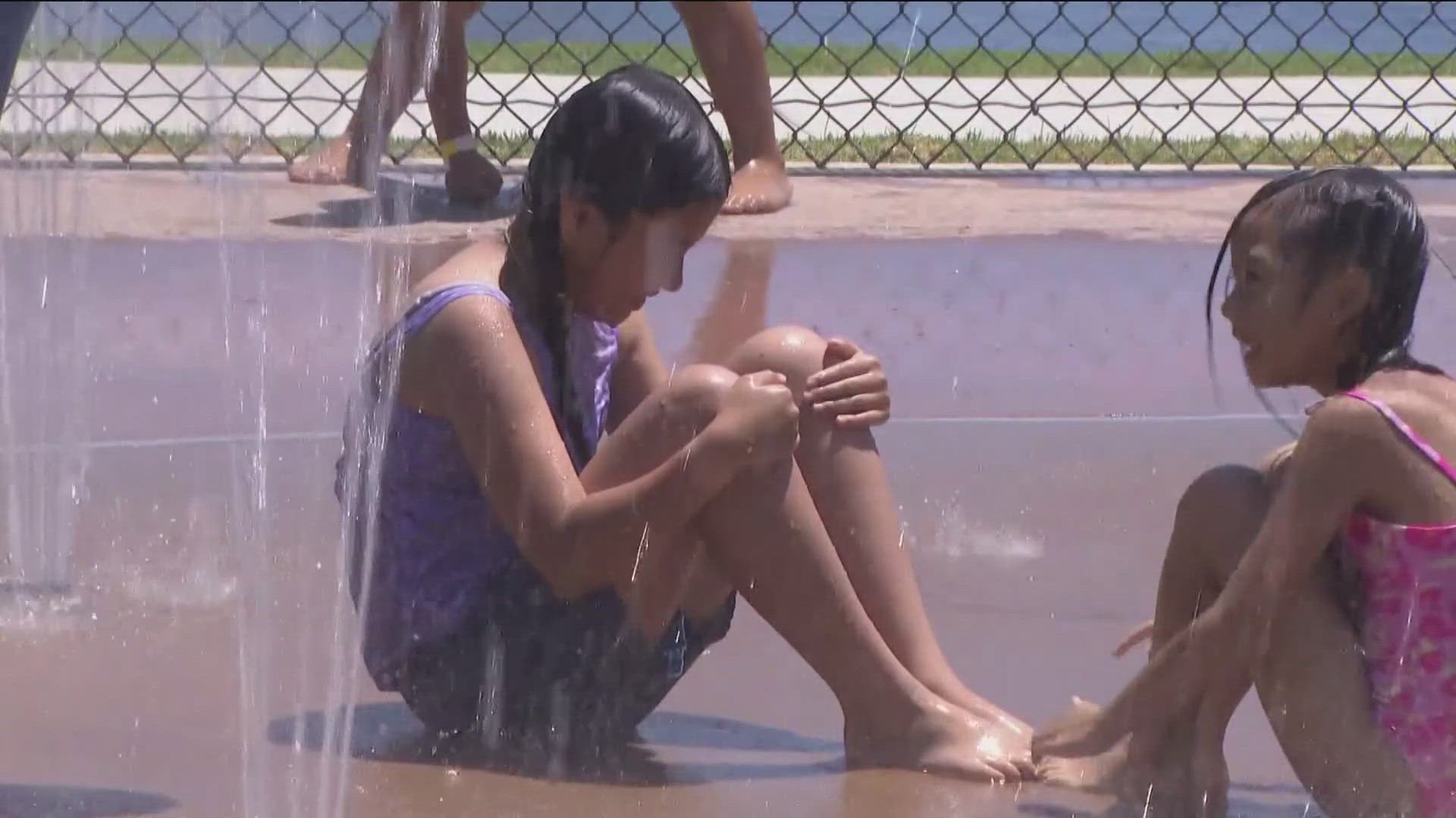
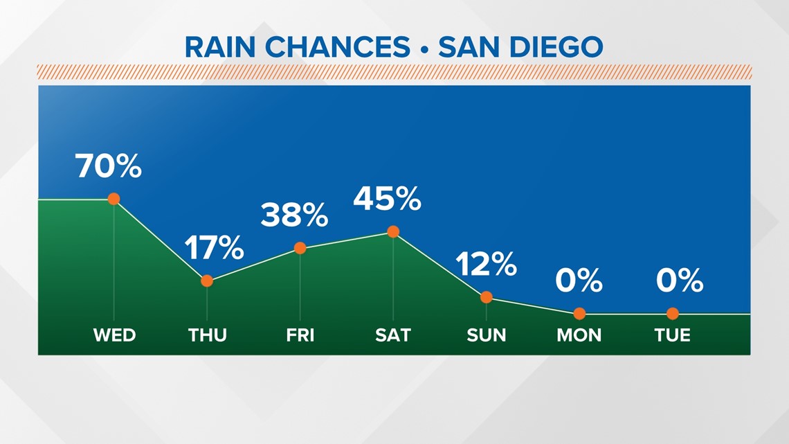
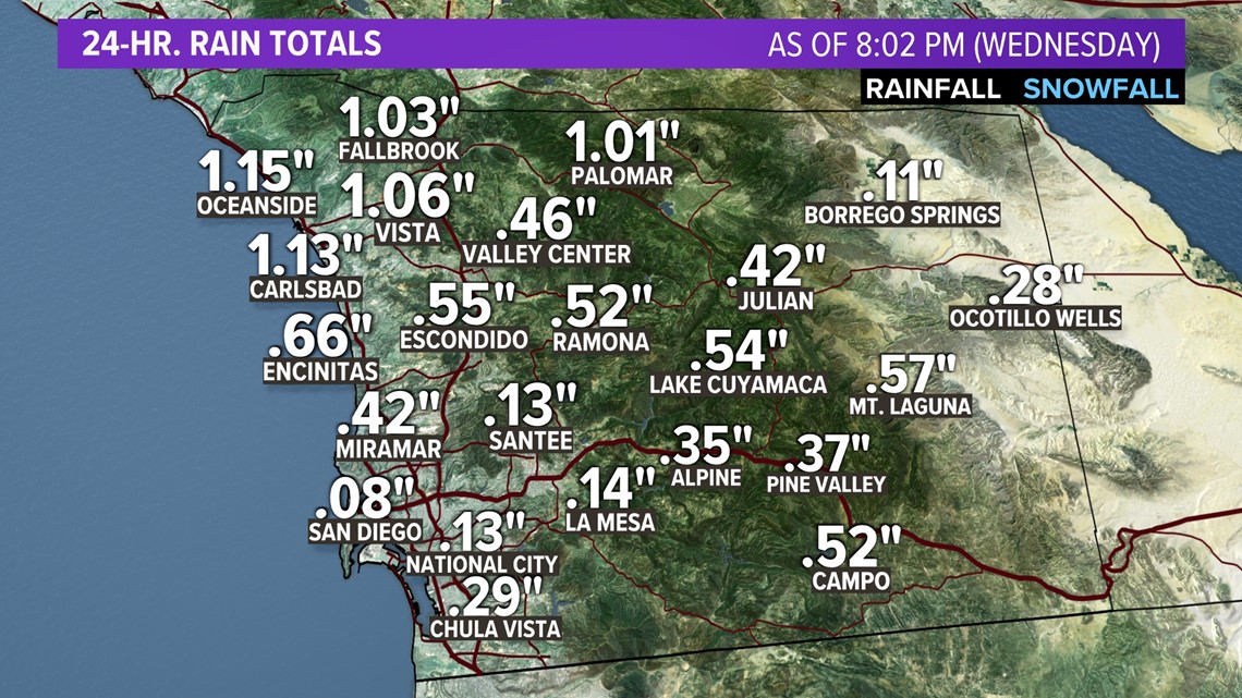
SAN DIEGO — Rain, wind, and strong wind hit San Diego County (and Southern California as a whole) through the day on Wednesday before tapering off overnight into early Thursday. We saw quite a mixed bag of inclement weather from heavy rain around North County to strong mountain wind gusts to thunder and lightning. Thursday into early Friday is expected to bring a break in the wet weather with an opportunity for some afternoon sunshine too. Another round of rain is expected late Friday through Saturday as this trough of low pressure begins moving east again.
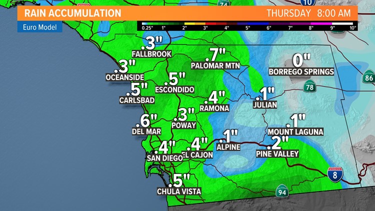
In total, the four-day stretch could bring roughly one inch of rain to most coastal and valley locations with slightly heavier accumulations around local mountain elevations, closer to 1.5 inches.
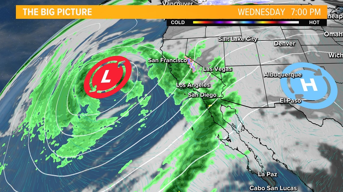
Other parts of the state are gearing up for slightly heavier rainfall, with up to 1.5 inches possible around San Francisco, and two to three inches possible around Big Sur. Most Southern California cities from Los Angeles through San Diego County will see roughly an inch in total of rain between Wednesday and Saturday with the bulk of that expected on the bookends (Wednesday and Saturday alone).

This will range at times from simply overcast skies to roughly a tenth of an inch of rain falling per hour. From early Thursday, current forecast models suggest between one-quarter inch and one-half inch of rain (0.25"-0.50") through the day and nighttime stretch.

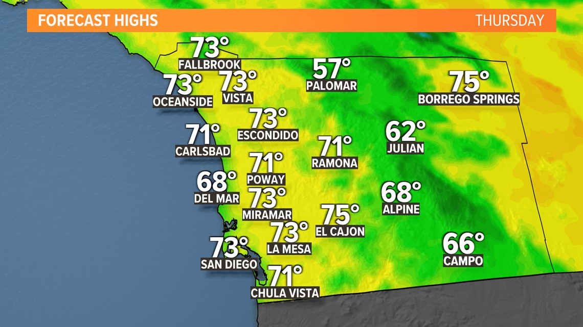

This storm is likely to stall off the Central California coast for Thursday and Friday, bringing a short lull in rain and wind with even the chance for some sun breaks in the process. Temperatures, however, will still be cooler than normal, and there's certainly a possibility of light to non-accumulating mist or drizzle in the process.
On Saturday, the impressive low-pressure system will begin its push onshore, bringing more measurable rain to San Diego County from late Friday through the day on Saturday. This second wave will likely bring similar accumulations as the first, between one quarter and one-half inch (0.25"-0.50") from Friday into Saturday.
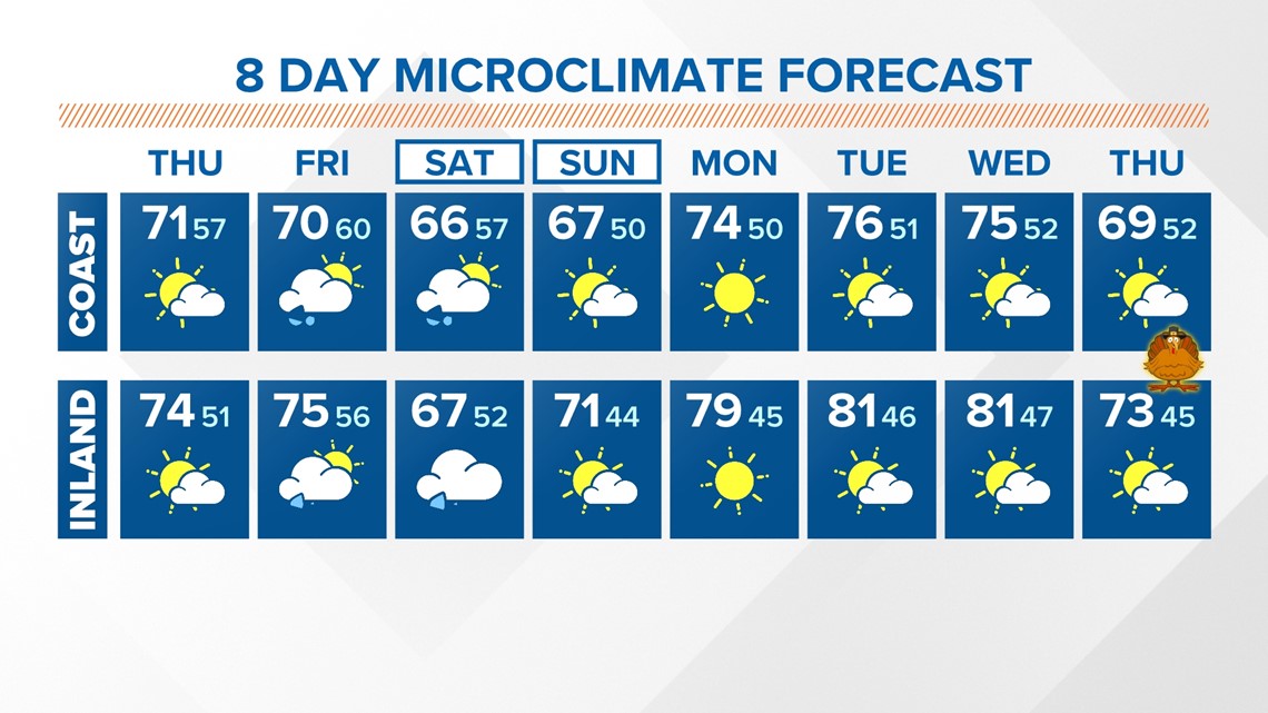
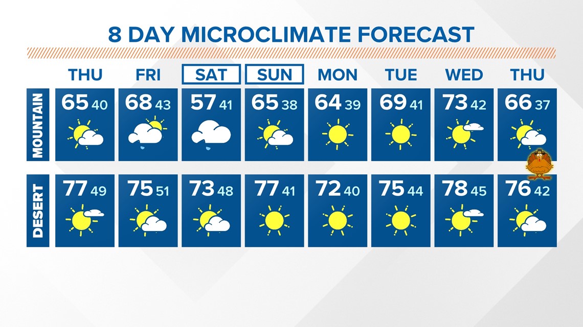
By Sunday, as the storm continues to push east, we will see a ridge of high pressure begin to build, allowing for sunshine and warmer temperatures to prevail into early next week. That means this total rain event is likely to bring between half an inch and one inch to most San Diego County locations with some models suggesting closer to 1.5" in a few spots, especially our local mountains.
Some are labeling this the first 'winter' storm to hit the area this season, but considering the rather high snow levels and that we're still in the fall season, it's tough to incorporate winter into this system all that much. The snow cutoff will be above about 8,000 feet, which will not include any San Diego County mountains and will also likely exclude most Southern California mountains in general.

Wind gusts will be most intense across local mountain passes and toward the deserts.
There is still a high amount of uncertainty with this storm and forecast models are likely to change as it moves closer. Stay up to date with our CBS 8 Microclimate Forecast for the latest on what to expect and how to plan the rest of your week.


Watch Related: San Diego has received more rainfall than Seattle so far in 2023 (Mar 23, 2023)