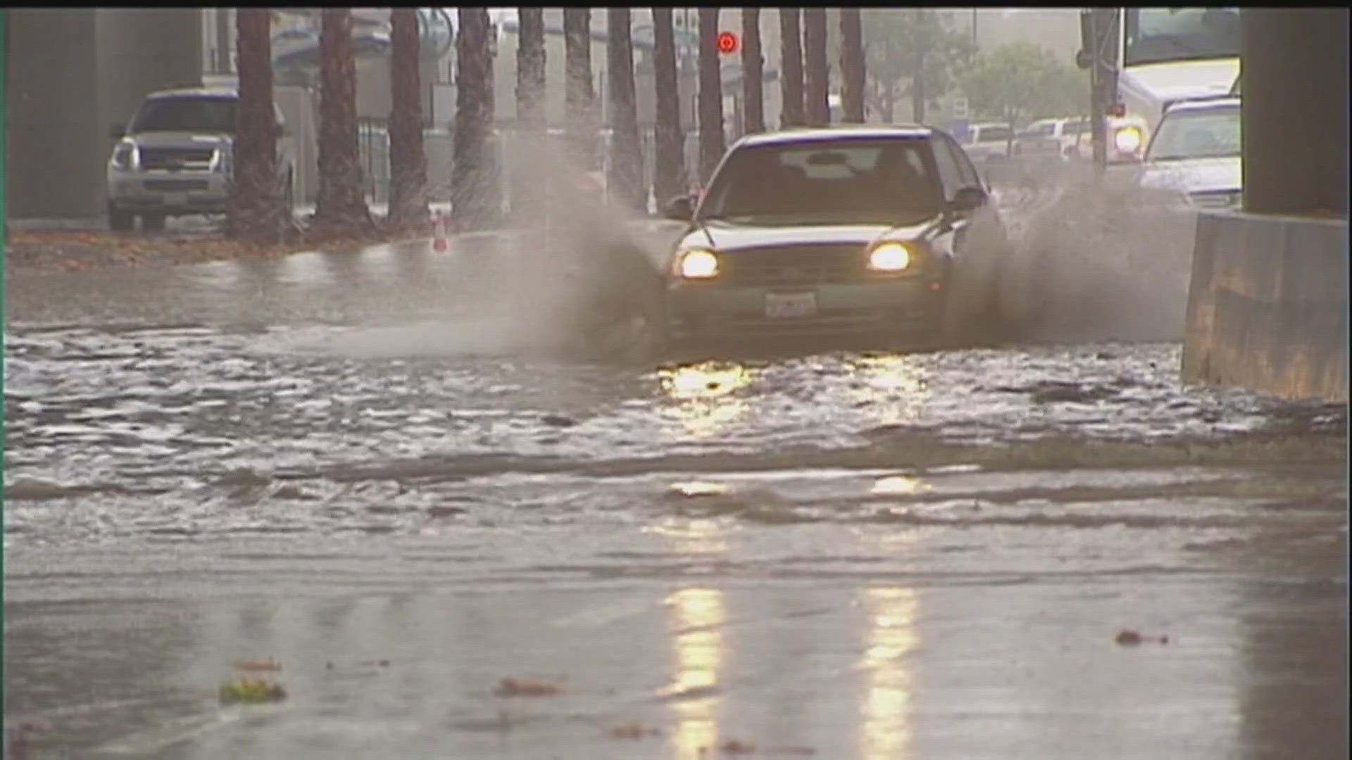
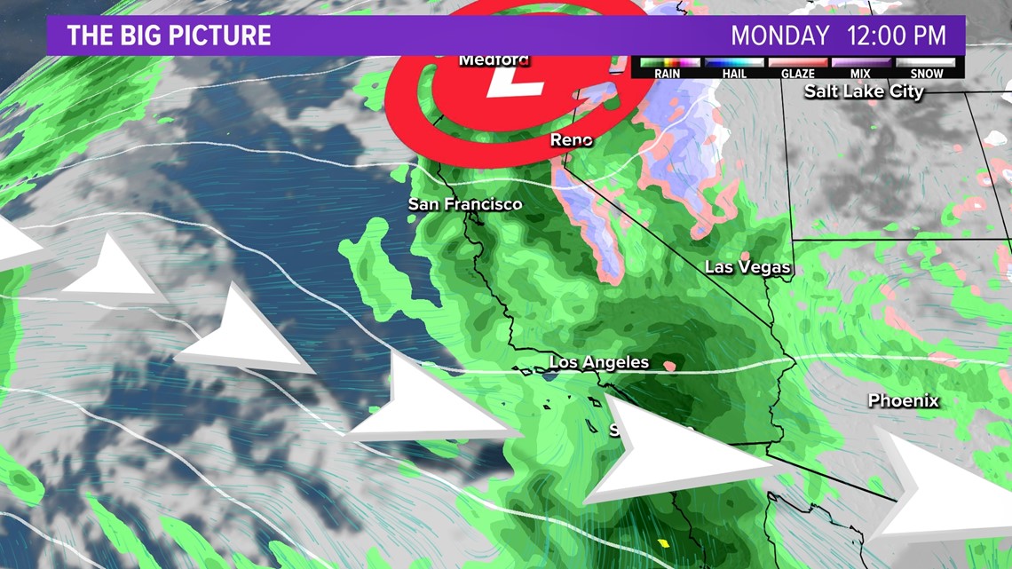
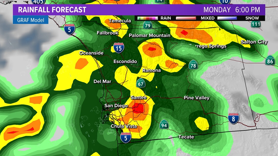
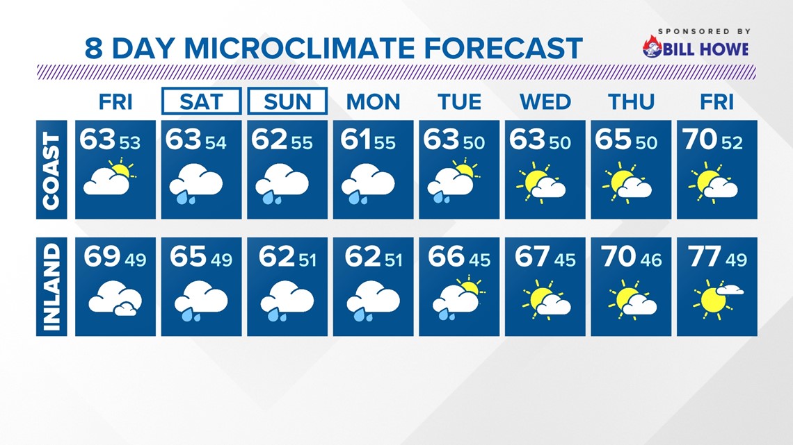
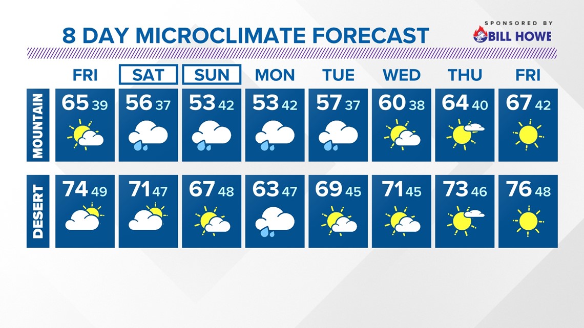
SAN DIEGO — San Diego County is bracing for the anticipation for periods of rain starting on Saturday and lasting until Tuesday of next week. This four-day stretch has a great potential of bringing moderate to heavy rain at times, especially on Monday showing the highest opportunity.
Showers will likely begin on Saturday with lighter activity expected before intensifying Sunday and again Monday.
That wet weather looks to completely taper off by Tuesday morning. Tuesday will have the lowest chance for accumulations. Because this is a warmer storm, snow is not expected at all across San Diego County, as the snow level will likely exceed 7,000 feet.
The latest forecast models have scaled back on Sunday being one of the more active days. They are leaning towards Monday, where we could be looking at moments of moderate and heavy rainfall with potential impacts from a broad atmospheric river.
After Tuesday, rain chances will drop as a ridge of high pressure builds in over the West. This will not only dry us out. Temperatures will also respond by climbing by the second half of next week. Expect daytime highs to peak warmer than usual with low 70s along the coast and upper 70s, maybe even a few low 80s possible, across the inland valleys.


High surf
Expect surf heights of 2' to 4' with a moderate risk of rip currents through Friday.
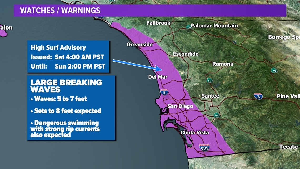
An incoming west swell will generate high surf over the weekend. The surf will be up to 4' to 6' with sets up to 7' with dangerous rip currents Sunday and Monday.
Advisories
High Surf Advisory | San Diego County Coastal Areas
Starting Jan. 20 at 4:00 a.m. through Jan. 21 at 2:00 p.m.



WATCH RELATED: King tides, high surf hit San Diego County again this week

