SAN DIEGO — On Sunday morning, Hilary was downgraded from a Hurricane to a Tropical Storm as sustained winds around the eye of the storm weakened to 70 mph.
Hilary will continue to break down and arrive in San Diego as a Tropical Storm, between about 2 and 4 p.m. on Sunday afternoon. Strong bands of rain and gusty winds will precede landfall, picking up in intensity through the morning and into the afternoon.
As of 9 a.m. Hilary was about 200 miles south of San Diego, traveling north with decent speed. The storm itself is moving at about 25 mph, which is a good sign, in terms of the likelihood of this storm passing through quickly rather than lingering or stalling overhead.
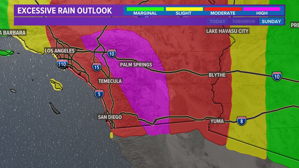
Pockets of severe thunderstorms will arise mainly over the mountain and desert communities but are possible countywide. Sustained speeds will likely be between 30 and 40 mph with gusts up to 75 mph at times.
After the eye of this storm passes north, we will still see rain and wind with some severe thunderstorms in San Diego from late Sunday through early Monday.


Wet weather does not appear to taper off completely until closer to early Monday morning.
Later this week we'll still see the chance of some pop-up thunderstorms each afternoon, but beyond that partly cloudy skies and warming temperatures are also expected.
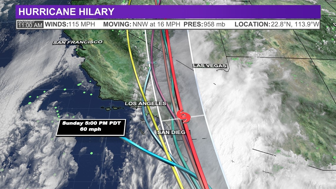
Spaghetti Model
Computer models of Hilary's projected path, known as 'spaghetti models' due to the resemblance of pasta noodles, show only a slight deviation expected in Hilary's path due to a low-pressure system in the Western Pacific mixed with a high-pressure system over the Midwestern United States, steering the storm toward San Diego and Southern California.


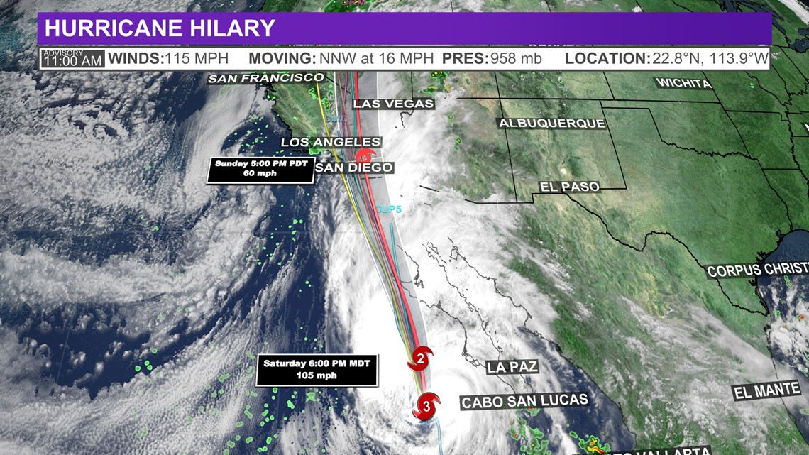
Hilary's Tropical Track
The "Cone of Uncertainty" shows the area where the center of the storm was expected to travel and also shows the anticipated timeline of when and how strong it might be at differing intervals. Note that impacts from a tropical system do occur away from the center and outside the cone.


Watches and warnings
A Flash Flood Warning has been issued for San Diego County. The warning went info effect at 11:25 a.m. until 2:30 p.m. Sunday.
A Flood Watch is in effect for San Diego's coastal and inland communities until 5:00 a.m.
A Flood Watch is also in effect for the desert and mountain communities of San Diego until Monday at 5:00 p.m.
Heavy Rainfall for San Diego
The storm itself is moving at about 25 mph, which is a good sign, in terms of the likelihood of this storm passing through quickly rather than lingering or stalling overhead.
Pockets of severe thunderstorms will arise mainly over the mountain and desert communities but are possible countywide. Sustained speeds will likely be between 30 and 40 mph with gusts up to 75 mph at times.
Click here to see our radar.

