
SAN DIEGO — Up to 50 mile per hour winds are blowing throughout San Diego County Wednesday. The winds knocked down trees across the county. San Diego City Public Works work to clear the blocked trees.
Power outages were reported all across the county, including in Del Mar, Torrey Pines, Clairemont, and Ocean Beach, according to SDG&E's power outage map.
On Tuesday evening, hundreds of residents in Carlsbad and Oceanside were without power after a power pole started a brush fire. The power pole was knocked down into water due to high winds. A portion of Jefferson will remain closed until SDG&E can safely restore power to the area.
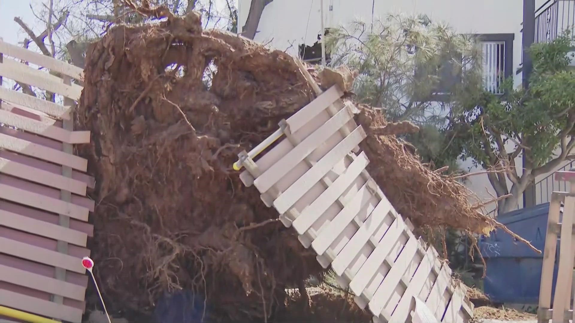
A large tree crashed into an apartment building near Morena Boulevard and Littlefield Street in Bay Park. A second floor apartment suffered the brunt of the damage. One of the tenants showed CBS 8 the damage from inside the apartment. She said it sounded like a big bang. She thought a truck had hit the building. Her friend was sleeping on the couch just feet from where the tree hit.
"She heard the windows shaking, she moved and then this tree crashed into the living room. She was like 'Oh my God!'" said the tenant, who asked not to be identified. "Very scary. Never had anything like this happen."
Fortunately, no one was hurt.
A large tree in La Jolla fell and penetrated the roof of a house due to the high winds. The elderly couple, who are not injured, were asleep when a light fixture above their bed fell.
The weather chaos is being caused by three strong storms that are heading to Southern California. The first one arrived Tuesday night. The storm will send cold Arctic air our way as the trough nosedives across the Great Basin, making more of an inland trek. Expect light to moderate rain Tuesday night through Wednesday morning with westerly winds being a larger threat for the day. The highest winds were expected to be over the desert mountain slopes, with peak gusts in excess of 70 mph. Winds could also be strong at the coast.
A second storm system will keep the chill in the air and reinforce a low snow level with its passage Wednesday night through Thursday. High temperatures on Wednesday and Thursday will be 10 to 20 degrees below normal, with most lower elevations topping out around 50 degrees both days. Some locations in the San Diego valleys might not make it out of the 40s those days.
WATCH RELATED: Cold winter storm bringing strong wind, rain, and snow the rest of this week
The third system will be a slow mover and bring more of a soaking to Southern California. This system is slated for Thursday night through Saturday, which looks to take more of an outside track over the Pacific Ocean and West Coast and tap into an atmospheric river. This system will bring more rain and mountain snow than the first two systems.
This will bring a much better opportunity for widespread, impactful rain across Southern California with wind still breezy but taking the backseat compared to the rain. Snow levels will be low for the rest of the week. Expect it is fall near 2,000 ft. for San Diego County mountains. As cold air lingers from a plunge in the jet stream, the snow level will slightly rise to 3,000 ft., which will lead to the potential for feet of snow in our local mountains with this long stretch of wet weather.
This daily chance for rain will exist from about Tuesday evening through Sunday morning. Most models look to taper off by Sunday afternoon and evening. While cooler temperatures will likely persist into early next week, our next best chance for sunshine will be Monday. But, it will only serve as the calm before the next storm. Another Winter storm will close in Tuesday and Wednesday of next week. This will bring more chances for rain and mountain snow to San Diego County.
WATCH RELATED: Windy weather hits Peoria, AZ ahead of Padres Spring Training
School Closures
The San Diego County Office of Education says that multiple school districts will be closed on February 22. Those districts include:
• Julian Union Elementary School District
• Julian Union High School District
• Mountain Empire Unified School District
• Spencer Valley School District
Weather Alerts
Interactive Radar Map | Follow as the storm systems move through San Diego County
Winter Weather Advisory | Inland Valleys:
Feb. 22 at 4:00AM - Feb. 23 at 10:00AM
Wind Advisory | Inland Valleys:
Feb. 21 at 10:00PM - Feb. 22 at 6:00PM
High Wind Warning | Coastal Areas:
Feb. 21 at 10:00PM - Feb. 22 at 8:00PM
High Wind Warning | Deserts:
Feb. 21 at 4:00PM - Feb. 22 at 6:00PM
Winter Storm Warning | Mountains:
Feb. 21 at 6:00PM - Feb. 25 at 3:00PM
High Surf Advisory | Coastal Areas:
Feb. 21 at 8:00PM - Feb. 23 at 3:00AM
Storm Preparedness & Resource Information
The Get it Done app can help you report blocked storm drains, potholes and broken street lights
Sign up for Alert San Diego notifications for all your telephone numbers
Report flooding to the City's emergency dispatch center at 619-527-7500
Report downed electrical lines or gas emergencies to San Diego Gas & Electric at 800-411-7343
ReadySanDiego.org has information on how to protect yourself and your property during a flooding situation
For more information on preparing for a storm and what to do during and after the rain, click here to be taken to the City of San Diego’s Storm Preparedness website.
WATCH RELATED: A mild start to the week before rain, wind and cool temps take over